


Voting District 0004, Edwards County, Texas
About
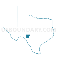
Outline

Summary
| Unique Area Identifier | 672752 |
| Name | Voting District 0004 |
| County | Edwards County |
| State | Texas |
| Area (square miles) | 388.41 |
| Land Area (square miles) | 388.13 |
| Water Area (square miles) | 0.27 |
| % of Land Area | 99.93 |
| % of Water Area | 0.07 |
| Latitude of the Internal Point | 30.15437980 |
| Longtitude of the Internal Point | -99.96227460 |
Maps


Graphs
Select a template below for downloading or customizing gragh for Voting District 0004, Edwards County, Texas


Neighbors
Neighoring Voting District (by Name) Neighboring Voting District on the Map
- Voting District 0001, Edwards County, TX
- Voting District 0001, Kimble County, TX
- Voting District 0002, Edwards County, TX
- Voting District 0003, Edwards County, TX
- Voting District 0005, Edwards County, TX
- Voting District 0005, Real County, TX
- Voting District 0007, Real County, TX
- Voting District 0410, Kerr County, TX
- Voting District 201A, Sutton County, TX
Top 10 Neighboring County Subdivision (by Population) Neighboring County Subdivision on the Map
- Ingram CCD, Kerr County, TX (11,698)
- Junction Southeast CCD, Kimble County, TX (3,323)
- Camp Wood-Leakey CCD, Real County, TX (3,309)
- Rocksprings North CCD, Edwards County, TX (1,389)
- Junction Northwest CCD, Kimble County, TX (1,284)
- Rocksprings South CCD, Edwards County, TX (613)
- Sonora Rural CCD, Sutton County, TX (419)
Top 10 Neighboring Place (by Population) Neighboring Place on the Map
Top 10 Neighboring Unified School District (by Population) Neighboring Unified School District on the Map
- Junction Independent School District, TX (4,279)
- Sonora Independent School District, TX (4,128)
- Leakey Independent School District, TX (2,138)
- Nueces Canyon Consolidated Independent School District, TX (1,934)
- Rocksprings Independent School District, TX (1,632)
- Divide Independent School District, TX (174)
Top 10 Neighboring State Legislative District Lower Chamber (by Population) Neighboring State Legislative District Lower Chamber on the Map
Top 10 Neighboring State Legislative District Upper Chamber (by Population) Neighboring State Legislative District Upper Chamber on the Map
Top 10 Neighboring 111th Congressional District (by Population) Neighboring 111th Congressional District on the Map
- Congressional District 21, TX (856,954)
- Congressional District 23, TX (847,651)
- Congressional District 11, TX (710,682)
Top 10 Neighboring Census Tract (by Population) Neighboring Census Tract on the Map
- Census Tract 9603.02, Kerr County, TX (7,942)
- Census Tract 9503, Sutton County, TX (4,128)
- Census Tract 9501, Real County, TX (3,309)
- Census Tract 9501, Kimble County, TX (2,387)
- Census Tract 9503, Edwards County, TX (2,002)